In today’s digital world, navigating unfamiliar cities, planning complex routes, or even discovering hidden gems in your hometown has never been easier—thanks to the power of online maps and navigation tools. Whether you’re a globetrotter, a commuter, a road-tripper, or someone who just loves exploring, understanding how to use these tools effectively can turn a good trip into a seamless and memorable journey.
While it’s tempting to rely solely on instinct or paper maps, digital navigation platforms have transformed travel planning, route optimization, and real-time movement into an art. This blog breaks down the best ways to harness these tools smartly, what features you should never ignore, and how to adapt them for various types of travel.
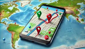
Why Digital Navigation Tools Matter
Online maps are no longer just about directions. They provide real-time traffic updates, public transport schedules, walking routes, terrain details, satellite views, local business listings, and user-generated reviews. Navigation tools today offer a personalized travel experience, adjusting routes dynamically and keeping you informed about roadblocks, tolls, or nearby attractions.
Whether you’re trekking through mountain trails or navigating busy urban centers, a reliable navigation strategy can save time, prevent stress, and enhance safety.
Popular Digital Navigation Tools (and Their Strengths)
Let’s begin by understanding the most widely used navigation platforms and their specialties:
1. Google Maps
Arguably the most popular and versatile map tool in the world. Google Maps offers:
- Real-time traffic and transit information
- Street View and satellite imagery
- Custom route planning for walking, driving, cycling, and public transport
- Location sharing and timeline history
- Offline map downloads
2. Waze
Known for its community-driven updates, Waze excels at real-time road conditions. It includes:
- Instant accident, hazard, and traffic jam alerts
- Voice-guided navigation
- ETA sharing with friends
- Preferred route customization based on driving style
3. Apple Maps
Especially useful for iPhone users, Apple Maps integrates seamlessly with iOS and Apple CarPlay. Features include:
- Turn-by-turn voice navigation
- Public transport directions in major cities
- Flyover and 3D city views
- Clean interface with privacy-focused data handling
4. Maps.me
Great for offline usage, Maps.me provides:
- Worldwide downloadable maps
- Hiking and walking trail details
- Hotel and restaurant listings with ratings
- No internet needed post-download
5. HERE WeGo
This platform is popular in regions with spotty data coverage. It offers:
- Turn-by-turn voice navigation
- Public transport schedules for over 1,300 cities
- Offline navigation for multiple countries
- Integration with ride-hailing services
Planning Ahead: Tips Before You Hit the Road
Using online maps efficiently starts long before the trip begins. Here’s how to prepare:
Download Offline Maps
This step is crucial when visiting rural areas, foreign countries, or zones with weak signal coverage. Most apps like Google Maps, Maps.me, and HERE WeGo let you download entire regions in advance, including turn-by-turn guidance and search capabilities.
Pro Tip: Download the map the night before when connected to reliable Wi-Fi and ensure your phone has enough storage.
Customize Your Route
Before starting your journey:
- Add multiple stops if you plan to visit more than one location
- Check for toll roads and adjust preferences accordingly
- Save key places (hotels, attractions, rest stops) using “Favorites” or custom pins
- Use Google My Maps to create personalized maps with color-coded markers
Understand Time Estimates
Navigation apps calculate Estimated Time of Arrival (ETA) based on current traffic, average speed limits, and real-time data. But always add buffer time, especially during rush hours, holidays, or in unpredictable weather.
During the Journey: Real-Time Navigation Tips
Keep Your GPS Settings Optimized
Ensure your device has:
- Location Services enabled
- High accuracy or “Precise Location” mode activated
- Battery saver off (it may restrict GPS performance)
Pro Tip: Carry a power bank to avoid battery drain during long use.
Use Voice-Guided Navigation
Listening to directions allows you to focus on the road instead of constantly glancing at the screen. Most navigation apps offer voice packs in different languages and voices. Adjust volume settings before you start driving or walking.
Pay Attention to Live Updates
Apps like Waze and Google Maps alert you to:
- Traffic slowdowns
- Road closures
- Accidents
- Police presence
- Construction zones
Use this info to reroute proactively rather than getting stuck unexpectedly.
Switch to 3D or Satellite Mode When Needed
For better orientation or complex intersections, changing from default map mode to 3D or satellite view can offer clarity, especially in cities with overpasses, tunnels, or complex road structures.
Specialized Navigation: Walking, Hiking, and Public Transit
Navigation tools are also incredibly helpful for non-driving travel modes.
Walking Navigation
Most apps offer pedestrian-specific routing, considering paths, crossings, and footbridges. Use it to:
- Explore cities safely
- Discover hidden alleys and shortcuts
- Avoid busy roads or dangerous areas
Hiking Trails
Apps like AllTrails, Komoot, and Maps.me specialize in outdoor navigation. These tools let you:
- Track your movement with GPS even offline
- Follow predefined trails with difficulty ratings
- Read user reviews on trail safety and terrain
Public Transportation
Google Maps and Apple Maps both support transit directions in most urban areas. You can view:
- Bus/train arrival times
- Route alternatives
- Platform numbers
- Transfers and walking time between stops
Pro Tip: Turn on notifications for delays or schedule changes.
Sharing Your Route and Location
For group trips, meet-ups, or safety, location sharing is invaluable.
Options include:
- Google Maps: Share live location with selected contacts for set durations
- Apple Maps: Use “Find My” app for real-time updates
- WhatsApp: Share live location directly in chat
- TripIt and Life360: For family tracking during travel
Location sharing ensures peace of mind for both the traveler and those at home.
Hidden Features You Might Not Know About
Saved Parking Spot
Google Maps lets you save your parked car’s location. Simply tap on the blue location dot and select “Save your parking.”
Measure Distance
You can measure distances between two points—helpful when planning hikes or bike rides. Long-press on the map to drop a pin, then use the “Measure distance” feature.
Augmented Reality (AR) Navigation
Google Maps on Android and iOS supports AR for walking directions in select cities. Hold your phone up and see arrows on the real world via your screen.
Indoor Maps
Airports, malls, stadiums, and large stations now often include indoor maps. They show gates, security lines, restrooms, and food courts to help navigate complex buildings.
Safety and Privacy Considerations
While navigation tools are extremely helpful, keep these safety guidelines in mind:
- Don’t interact with your phone while driving. Use voice guidance or a mounted display.
- Use headphones or keep volumes low when walking in busy areas.
- Review app permissions to avoid unnecessary data collection.
- Use secure apps and avoid public Wi-Fi for location-based tasks.
- Disable location history if you’re concerned about privacy.
Final Thoughts
Online maps and navigation tools are more than just direction providers—they’re personal travel assistants that offer smart solutions to help you move with confidence and efficiency. Whether you’re exploring a new city on foot, planning a cross-country drive, or navigating subway lines in a foreign language, using these tools effectively makes every journey smoother and more enjoyable.
Incorporate them into your travel routine thoughtfully. Explore their features, download offline content, and keep your battery charged. The world is easier to explore when your route is clear and your tools are reliable.
Happy navigating!